
Table of Contents
- Enhancing Construction Planning and Monitoring
- Optimizing Agricultural Practices
- Advancing Public Safety and Emergency Response
- Environmental Monitoring and Conservation
- Infrastructure Inspection and Maintenance
- Mining and Resource Exploration
- Telecommunications Infrastructure Management
- Conclusion
Aerial photogrammetry has rapidly transformed how industries map, monitor, and analyze landscapes and structures. By offering precise and efficient solutions, it has become an essential tool for professionals seeking to increase productivity and accuracy. Companies, such as a land surveying company in Virginia, are increasingly utilizing aerial photogrammetry to deliver detailed insights for planning and development.
This article explores the wide-ranging uses of aerial photogrammetry, from enhancing construction project management to supporting environmental conservation. With recent technological advances, industries now operate with greater efficiency and confidence, confirming aerial photogrammetry’s role as a critical catalyst for innovation and progress.
Enhancing Construction Planning and Monitoring
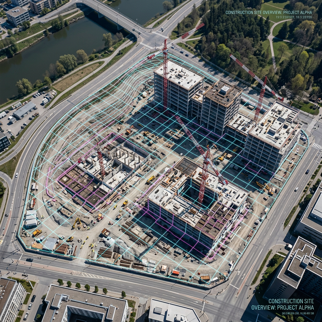
The construction sector has seen major improvements in site surveying, planning, and quality control due to aerial photogrammetry. 3D models generated from drone imagery enable project managers to monitor progress and identify issues early, reducing on-site delays and unexpected errors. These digital insights help streamline workflows and make construction phases more predictable, ultimately lowering costs and risks.
Today’s construction projects are often more complex and larger in scale, requiring up-to-date, highly accurate site information. By capturing an aerial perspective, photogrammetry provides construction teams with regular updates on project status. These updates can be quickly shared with stakeholders, making collaboration between project managers, architects, and contractors smoother. Additionally, photogrammetry supports logistical planning by assessing site accessibility and material storage needs, thereby increasing overall site safety and organization. Construction companies that regularly use aerial photogrammetry report higher rates of early problem detection and significant reductions in rework costs, underscoring its value throughout the project lifecycle.
Optimizing Agricultural Practices
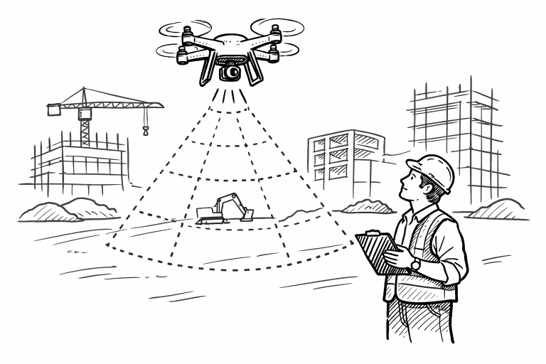
Aerial photogrammetry enables farmers to manage their fields more effectively by providing high-resolution images of crops and soil. This technology helps identify areas of nutrient deficiency, pest infestation, or over- and under-irrigation. By adopting drone-based mapping, agricultural operations are becoming more precise and productive, resulting in higher crop yields and more efficient resource use. For more information on agricultural technologies, visit Successful Farming’s article on drones showing their value in agriculture.
Another significant advantage is the ability to analyze seasonal crop changes more efficiently. By conducting regular aerial surveys throughout the growing season, farmers can track plant health trends over time and respond proactively to emerging issues. This contributes to sustainable farming practices and minimizes the environmental footprint of modern agriculture. Furthermore, integrating photogrammetry data with farm management platforms enables detailed record-keeping and compliance reporting for agricultural regulations, streamlining the farm-to-market process.
Advancing Public Safety and Emergency Response
During natural disasters and emergencies, response teams use aerial photogrammetry to assess affected areas quickly. Real-time maps and models allow rescuers to allocate resources effectively and assess hazards without endangering personnel. The integration of artificial intelligence with drone technology delivers faster data processing and more actionable insights during search and rescue or post-disaster recovery.
First responders also leverage aerial photogrammetry for crowd monitoring at large events, incident documentation, and fire risk assessments. Law enforcement agencies can produce comprehensive scene reconstructions for investigative and legal purposes within hours. The versatility of photogrammetry helps coordinate multi-agency responses, reduce response times, and provide transparent communications with both public officials and citizens during critical situations.
Environmental Monitoring and Conservation
Conservationists and environmental scientists rely on aerial photogrammetry to monitor ecosystems, observe wildlife habitats, and track deforestation rates. Detailed digital maps help inform strategies for ecosystem restoration and conservation policy. The ability to generate AI-enabled digital twins of environments provides dynamic models for tracking environment changes in real time. This technology has been instrumental in a variety of global conservation efforts, as described by National Geographic’s feature on drones in environmental science.
Moreover, photogrammetry supports long-term studies of erosion, changes in waterways, and wetland health by providing consistent, repeatable data at frequent intervals. This helps organizations respond more rapidly to the impact of climate change by basing interventions on reliable evidence. Citizen science projects also use drone-captured images to involve local communities in data collection and stewardship of natural resources, broadening the reach of environmental advocacy and education.
Infrastructure Inspection and Maintenance
Aerial photogrammetry is widely used to inspect bridges, pipelines, railways, and power lines. By collecting precise imagery, organizations can identify faults or wear and tear before they become critical. This reduces the need for manual inspections, thus lowering costs and minimizing the risks associated with working at height or in hazardous conditions. The technology’s efficiency has led to faster maintenance response times and more reliable infrastructure management.
For long-span bridges and remote infrastructure, the ability to collect detailed, up-to-date images without disrupting regular operations is invaluable. Advanced analytics tools further analyze this captured data to predict future maintenance needs and guide preventive interventions. Consequently, infrastructure owners can optimize budgets, extend asset lifespans, and maintain regulatory compliance with greater ease than ever before.
Mining and Resource Exploration
The mining sector benefits from aerial photogrammetry’s ability to generate accurate topographic maps that detail terrain and excavation sites. With these maps, mining companies can identify mineral deposits, plan safe excavation routes, and monitor waste management practices. Artificial intelligence is now being integrated with photogrammetric mapping to enable faster mineral classification and safer site evaluations, setting new standards for operational efficiency in the mining industry.
Photogrammetric surveys are also advantageous for environmental compliance and reclamation planning, ensuring mining operations adhere to safety and sustainability standards. Stockpile volumetrics, slope stability analysis, and real-time tracking of fleet movements can all be enhanced with regularly updated photogrammetric datasets. The increased frequency and precision of these surveys radically improve decision-making and operational transparency across the resource sector.
Telecommunications Infrastructure Management
Telecommunication providers use aerial photogrammetry for the inspection, maintenance, and planning of cell towers and other network elements. Digital inspections deliver quick and detailed assessments, supporting timely maintenance and upgrades. Partnerships between telecom operators and photogrammetry software developers are enhancing the digital management of infrastructure, making it easier to maintain network reliability and expand coverage efficiently.
As 5G networks and other advanced technologies are deployed, aerial photogrammetry enables companies to rapidly assess the suitability of new sites, optimize existing coverage, and ensure the structural integrity of towers. The digital records generated from each photogrammetric survey are invaluable for demonstrating compliance with industry regulations and streamlining the permitting process for new installations. These innovations empower providers to deliver more resilient and extensive service networks to both urban and remote areas.
Conclusion
Aerial photogrammetry continues to lead innovation across industries by delivering high-quality mapping, monitoring, and analysis solutions. Its applications span from construction and agriculture to emergency response and conservation. As more sectors adopt real-time data processing and artificial intelligence, aerial photogrammetry will further enhance operational efficiency and decision-making capabilities, establishing it as a foundational technology for the future.
Looking forward, as hardware and software integrations become more seamless, the accessibility of photogrammetry will widen, benefiting small businesses and large enterprises alike. Industry leaders predict that fully automated drone missions, driven by AI, will provide continuous, real-time data streams for smarter cities, renewable energy management, and beyond. Educational institutions and vocational programs are incorporating photogrammetry training, ensuring a pipeline of skilled professionals ready to advance this technology further. Ultimately, aerial photogrammetry stands poised to shape modern infrastructure, public safety, and sustainability efforts for generations to come.
Discover more from The Cameron Journal
Subscribe to get the latest posts sent to your email.